If you’re used to old-style maps, you may wonder who squashed Greenland. No one. In the image its size relative to that of other land areas corresponds to its actual size, less than one-tenth that of Africa. This map, based on the Equal Earth projection, relies on algebra, geometry, and trigonometry to represent land masses and their shapes more accurately than many commonly used map projections do, such as the Mercator. Yet, unfortunately, it is not perfect, because any method that is used to project a sphere onto a two-dimensional plane must involve some distortion: a flat map can’t faithfully display all the features of a globe. Mapmakers recognize this and choose what aspects, such as area, shape, direction, and distance, they want to retain and those they are willing to sacrifice. For example, the Mercator projection was handy for sailors in that every straight line represents an actual compass bearing, but it makes Greenland and Russia appear bigger than Africa.
Why not peel off the surface of a globe and glue it onto a piece of paper? Not a bad idea, but getting the surface on the paper requires cutting or squashing (try it with an orange peel). Although it is hard to prove a negative, it has been proved that a perfect map--one that would preserve all the characteristics of a globe--is impossible. Cartographers haven’t given up, however. They use math as a basis for the techniques to create maps along with the measures to quantify their imperfections, so that different approaches can be evaluated and compared.
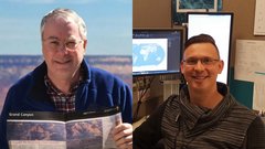
Tom Patterson and Bojan Šavrič discuss the Equal Earth projection map that they created with Bernhard Jenny. (They discuss the Gall-Peters projection, which you can view here.)
For More Information: "The Equal Earth map projection," Bojan Šavrič, Tom Patterson, and Bernhard Jenny, International Journal of Geographical Information Science, Vol. 33, no. 3, 2019.


 Korean
 Polish